
How to use your Garmin GPS in Japan (Free Map Download)
Do you want to use your Garmin GPS device in Japan with a proper map? If so this post is for you. We’ll show you the steps to downloading and installing OpenStreetMap on your Garmin so you can start exploring with your GPS today.
Table of Contents
No Japan maps?
You’ve arrived in Japan brimming with excitement for your cycling trip.
You’ve been training on the bike, studying some local phrases, made a list of food you want to eat and planned all the amazing places you are going to visit.
You uploaded all of your cycling routes to your Garmin before arriving and as you turn on your device from Europe or North America the maps don’t seem right. They seem strange and kind of broken.

This is a common occurrence for overseas riders. We’ve had countless cyclists set up and check their Garmin before leaving and be faced with the thought of not having their maps, routes or a working Garmin with them on their trip.
Thankfully, there is a free solution and I’ll outline the step by step process to get your Garmin device working in Japan today.

Using OpenStreetMap
There are a couple of ways to get your Garmin working normally while in Japan.
One option is to buy the Garmin Map of Japan and install it on your Garmin. On top of having to pay for the maps, it’s actually pretty hard to navigate the Garmin website and find the correct download for Japan.

The other option is to use maps from OpenStreetMap, which is a free wiki world map built by volunteers and contributors. OpenStreetMap is open data which means you are free to use it as long as you credit OpenStreetMap and its contributors.
We offer the data for download on our site and full credit goes to “© OpenStreetMap contributors”. You can read more about the foundation here and also view their copyright and license page here.
We installed the OpenStreetMap on our Garmin Edge Touring GPS and have used it for the past two years without problems.
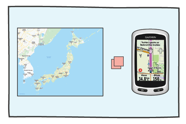
We bought our Garmin in Europe so it came with detailed maps of Europe of course but didn’t include the maps for Japan or for the rest of Asia. It’s a bit hard to use a GPS unit if the underlying map shows you swimming in an ocean.
We followed the below steps to get our device up and running in Japan and we hope they also work for your device.
Installation steps:
- Download the OpenStreetMap_Japan_contours file from the TMZ site.* – use google translate if needed.
- Unzip the zip file
- Insert your SD-card into your SD-card reader. If you don’t have an SD-card reader you can connect your Garmin directly GPS to your computer using a USB cable. Make sure that the SD-card is in the GPS unit before you plug it into the computer
- Open the SD-card with the file manager or finder. If there isn’t a folder on the SD-card called Garmin, you need to create one. Garmin must start with a capital ‘G’
- Copy the gmappsupp.img file into the Garmin folder on the SD-card
- Safely remove or eject the SD-card and insert into Garmin or eject the Garmin from the computer
- Turn on your Garmin. You’ll need to enable the “Japan OSM” and disable other Maps. The way to enable the Japan OSM map varies depending on the GPS unit. Try either of the following:
- Tools > Settings > Map > Map information
- Tools > Trip Pages > Map > Map information > Select Map

*Use the top right zip file link for the most recent update with contours.
Video Support (Old site version)
Once again, we did this process on a Garmin Edge Touring but we have read and heard it also works with Edge 530 / 705 / 810 / 820 and 1000 devices.
Tips on using the Garmin Edge Touring
If you have little or no experience using a Garmin GPS then this section is written with you in mind.
Generally, we find our Garmin Edge Touring works best when the routes have been prepared prior to riding and the GPX route files have been uploaded in advance.
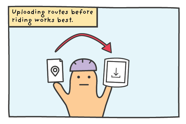
If you have your routes prepared and you are renting a RBRJ GPS unit you can send the GPX files over and we’ll happily upload the routes to the GPS unit before your rental starts.
If you would like to ride a RBRJ route you’ve seen on our blogs or Strava, just let us know the routes and we’ll make sure it’s uploaded and ready for your rental.
Uploading your own routes (GPX files)
For riders on a multi-day tour and bringing their own PC, we will also provide the Garmin USB cable so you can upload your routes (GPX files) directly to the device on the go.
To upload new routes, follow these steps:
- Plug the USB cable into the PC and connect the Garmin
- The Garmin File and an Unnamed File will appear on your desktop
- Open Garmin File and locate ‘New Files’ Folder
- Drag and drop the route file into New Files
- Wait for transfer then safely remove Garmin
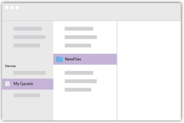
After you upload the routes, you can access them by following the below steps in the device menus:
- Where to
- Saved
- Courses
- Route name
- Ride
Notes on the Route Planner
It is possible to use the inbuilt Route Planner on the Garmin if you haven’t prepared any routes but we try and use this as a last resort. The routes the Garmin creates are hit and miss and it can be time consuming using the small screen to select starting points and destinations.
We find the device really shines when navigating on a pre-loaded route and we are constantly impressed by the more subtle directions it provides in complicated sections.
Final thoughts
If you want to use your own Garmin in Japan (with a proper map) OpenStreetMap is a lifesaver. Just follow the instructions in this post and hopefully you’ll be navigating the cities, towns and mountains like a local.
If you don’t own a GPS but are thinking of buying or renting one for your trip we recommend getting one. The device is great at navigating and by leaving the directions to the GPS unit you won’t have to check your phone as much meaning you can save battery and spend more time taking in the sights.
Has anyone used the file and instructions in this blog successfully? Has anyone had any problems? We’d love to hear your experiences so get in touch if you have any questions or feedback.
Stay safe and happy cycling!
