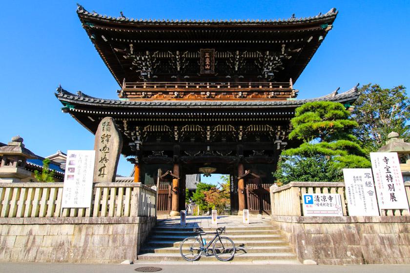
North Hills of Kyoto Cycling Guide and Route
The hills north of Kyoto are stunning especially while cycling. Experience rolling hills, lush forests, isolated villages and scenery that combine for some truly magical moments on the bike on the North Hills of Kyoto Cycling routes.
Table of Contents
- Introduction
- Route
- Getting out of the City
- Arashiyama
- On to the hills
- Route 162
- Nakagawa Village
- Forest roads
- The Return loop: The 367, Kamo and Katsura Rivers
- Points to Watch
- Final thoughts
Introduction
For any road cyclist visiting Kyoto, the lure of the luscious green mountains that surround Kyoto will be inescapable. The backdrop to the ancient capital, pure and simple just makes for great cycling. The North Hills of Kyoto provides some of our favorite cycling around.
See a part of the route and get a feel for the area from the below video.
There are many great routes around but we’ve put this 72km route together give cyclists a chance to escape the crowded tourist spots and find a little bit of isolation on these wonderful roads and paths through rolling hills, secluded forests and small rural villages when time almost stands still.
We also run private group or solo tours through these mountains.
For cyclists looking for a shorter alternative we have a 58km version which is also described below.
Route
72km version
58km version
Getting out of the City
After a short, but straight forward ride across the south end of Kyoto you will find yourself on the Katsuragawa. (Katsura River). This river has a marked cycling path along it that is part of the Keinawa Cycling road. It’s a great way to go North/South along the West side of Kyoto.

The river is great for cyclists as it provides a beautiful and efficient means of getting north to south (and vice versa) while skipping the traffic and busy city streets.

We press on to the north and will arrive shortly at the picturesque Nakanoshima bridge just before Arashiyama.
This bridge is gorgeous but it’s also no secret either so more than likely you’ll have to hop off your bike and walk over the bridge to navigate the crowd and reduce the chance of accidents.

Arashiyama
With both Natural and manicured beauty it’s easy to see why Arashiyama is a popular tourist spot. When I first came to Japan, Arashiyama quickly became my favourite of the renowned sights in Kyoto.
Even with crowds increasing yearly, it’s still quite easy to find a quiet place in the trees next to the river to appreciate the beauty of the surroundings.

However, this ride is all about escaping the crowds and zipping past Arashiyama on a bike is one of the best ways to quickly take it in.
We do recommend reducing your speed and keeping a close eye out while riding through the area as visitors are not always paying attention and may cross the street without warning.
You’ll head over the main Arashiyama bridge (Togetsu-kyō Bridge) and along route 29 towards Seiryou Temple.

On to the hills
Once at the junction in front of Seiryou Temple, turn right and follow route 29 east, paying attention to the small left then right turn at the first lights.
The 29 will continue east past some farm areas and the peaceful Hirosawa Pond making for a lovely ride as you edge closer to the mountains.

You’ll come to an intersection where you take a left and follow the sign to Takao and into the first climb of the ride on the 162.
The climb has some pretty steep bits and no doubt you’ll be reaching for your low gears as your cardiovascular system finds a rhythm in order to pull you up the hill.
The local town provides a pleasant distraction as you pass traditional houses billowing out smoke from the chimney and some beautiful turns and bends along the local road.

Route 162
Meandering through the green hills north of Kyoto route 162 passes through the villages of Umegahata as picks up the Omuro River and then Kiyotaki River at Takao.

The sound of white water ebbing and flowing back down to Kyoto can be heard along much of the route and you have the option of stopping off at the secluded Kosanji Temple. The Route is part of the Shuzan-Kaido which historically was used for transporting fish from Obama to Kyoto.

If you were to continue straight on 162 it would also take you to the quaint village of Miyama Kayabukino Sato famed for its traditional Japanese architecture and thatched roofs.
As you continue the ride through the lush forest you’ll be treated to more beautiful scenery as the roads wind and bend along the river. The elevation gradually builds at times which results in some magical moments looking out and down into the forest valley and river below.
You’ll get to a 300m tunnel which can be avoid with a detour as long as the path is open. You’ll notice our route on this page goes through the tunnel but if the detour path is open, you should take it.

Whether the gate is open will depend on the safety of the path which is at threat from landslides and debris.
If the path is open the route veers up and around to the left for a beautiful viewing spot of the road below heading into the tunnel.

Nakagawa Village
Whether you go through the tunnel or take the path, you will then turn right before the next tunnel and head into the wonderful village of Nakagawa as part of the detour.

Following the Kiyotaki River, the road twists and turns through this small but attractive village.
Old wood storage houses can be found at the bottom of the steep slopes on the other side of the river and are connected to road via an array of small yet simple bridges, demonstrative of Japan’s need to utilize space.

You’ll rejoin the 162 before turning right onto Route 31 and then left onto 107.
Forest roads
Following the signs for Mayumi, you’ll begin climbing the 107 through the forest, which follows the Mayumi River upstream.

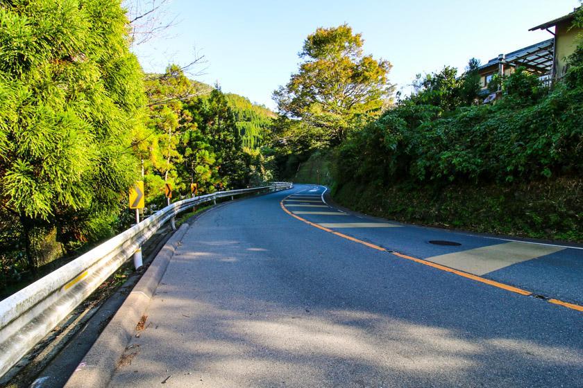
Some of the road sections are quite narrow so take care. It’s easy to feel a sense of escape with the hustle and bustle of Kyoto left behind as you ride on these quiet forest roads.
Cars are quite rare here but still pay attention. You’ll also need to pay attention to your GPS as a right turn is required (see below) to continue following the 107.

Here the gradient increases as you begin climbing and weaving through the forest to your maximum elevation of 400 metres. It’s easy to pick up speed on the descent down to Route 61 but the roads are narrow and bend sudden so take a lot of care.

It’s as you turn right on to Route 61 that you’ll first pick up the Kamo River. The road is wider here and makes for fun descent along the side of the Kamo River.
If you just want to complete the 58km loop then continue back down to Kyoto on the 61. If you are not done yet then turn left at route 38 to begin climbing again and then right onto route 40 after several kilometres.

The Return loop: The 367, Kamo and Katsura Rivers
There is a progressive climb on route 40 but once you begin the descent back down towards the 108 and 367 the hard work is done. A right turn onto the 108 will then run you through a series of sweet-smelling Daikon (Japanese Radish) farms and alongside the Takano River before turning right onto the 367 which leads you back down to Kyoto.
At Demachiyanagi, the Takano River runs into the Kamo River and it is here where you can get on riverside paths of the Kamo River.
Points to Watch
Large pothole on tunnel detour
There is a large part of the road on the tunnel detour that has fallen away creating a large and dangerous pothole. The pothole is on the left side of the road and it’s after the second bend to the right.

Steep and narrow section
There is a steep section coming down the 107 before the right turn onto the 61 and Kamo river. The road is quite narrow and some corners it can be difficult to see if cars are coming the other way. It’s better to play it safe and slow down before bends and be sure to check the mirrors when they have them on the blind corners.

Final thoughts
Kyoto offers so much for cyclists. The surrounding mountains, valleys and river provide climbs, descents, remarkable scenery and unmistakable Japanese charm.
The mountains in the north offer all of this while also being easily accessible, especially from the Katsura and Kamo rivers.
This route also takes in the world-famous Arashiyama as you zip past on your bike, and away from the crowds and into the mountains. The route gets quite deep into the vibrant forests providing a thick dose of nature and a true escape from the hustle and crowds of the city.
Quite frankly, the ride is outstanding. No matter how much you want to find your cycling flow the beauty of the scenery will no doubt have you stopping for photos or to admire the surroundings you are riding your bike through.
This ride gets a solid 5 stars and we hope you get a chance to explore it.
