How to Cycle from Kyoto to Osaka – Guide and Route
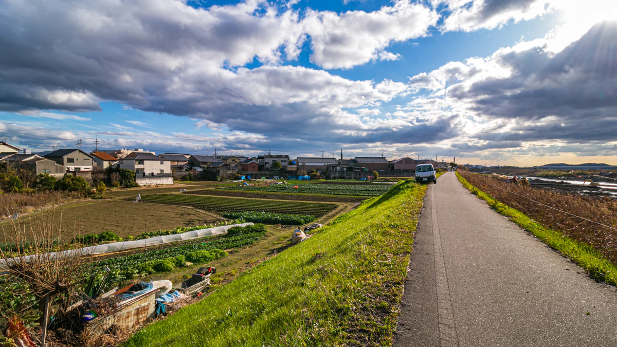
Cycle from Kyoto to Osaka along the Yodogawa! The ride between Kyoto and Osaka is a classic Kansai route. Experience the river-side cycling paths, thick vegetation, country-side views and more on this 50km ride for all levels.
Table of Contents
- Introduction
- Route
- Katsura river start
- Left to Kamo river
- Three river crossing – Katsura, Uji & Kizu rivers become the Yodo river
- Ride the Yodo river into Osaka
- Oo river to finish
- Final thoughts
Introduction
This route is a staple for both local cyclists and riders traveling in Kansai.
For travelers basing themselves in Kyoto the ride to Osaka is a great work-out and way to get to Osaka in order to check out the city or catch your flight from Kansai (KIX) or Itami (ITM) International airports.
From Kyoto to RBRJ Osaka the ride is around 50km but if you’re coming from central or east Kyoto the ride could be 55km – 60km.
Route
Distance: 50km
Elevation Gain: 68 m (minimal hills throughout the ride with no climbs)
Navigation and route tips
The route follows the Katsura and Yodo rivers which makes the ride relatively easy to navigate however there are some tricky areas especially for first time riders.
We have outlined the key areas you should pay attention to and included illustrations showing the correct route along with any extra information.
Katsura river start
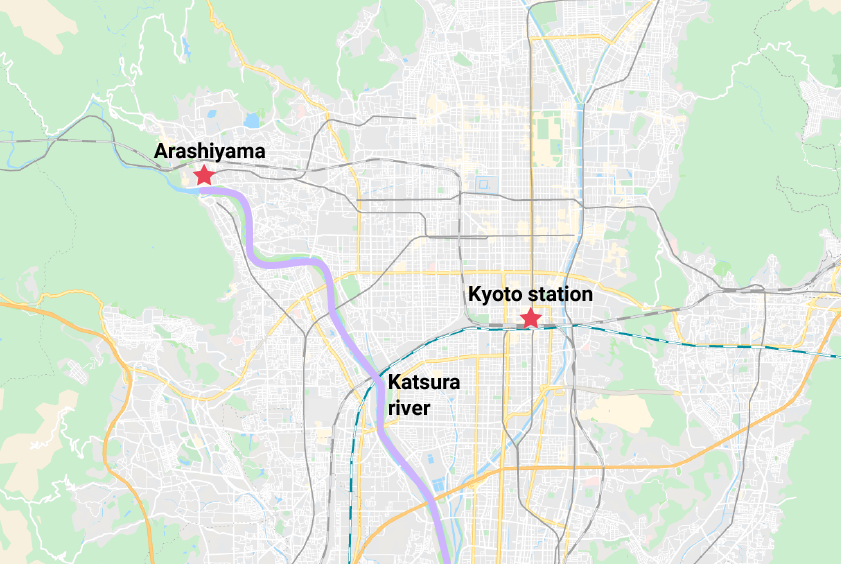
To start the ride, you should head over to the Katsura river in the west of Kyoto.
The river is easy to get to from most areas of Kyoto. If you are starting around downtown Kyoto (Karasuma etc) simply head west until you get to the river then get onto the cycling path from one of the many ramps near bridges.
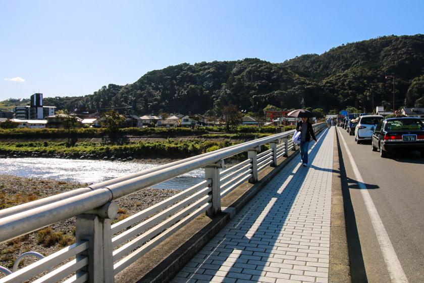
The cycling path is well maintained and not all that crowded with other cyclists or pedestrians, even on weekends with locals utilizing the path.
Nishioo bridge crossing
You’ll ride for 3km on the west side of the river before you go under the Nishioo bridge then loop around and up onto it as you head to the east side of the river.
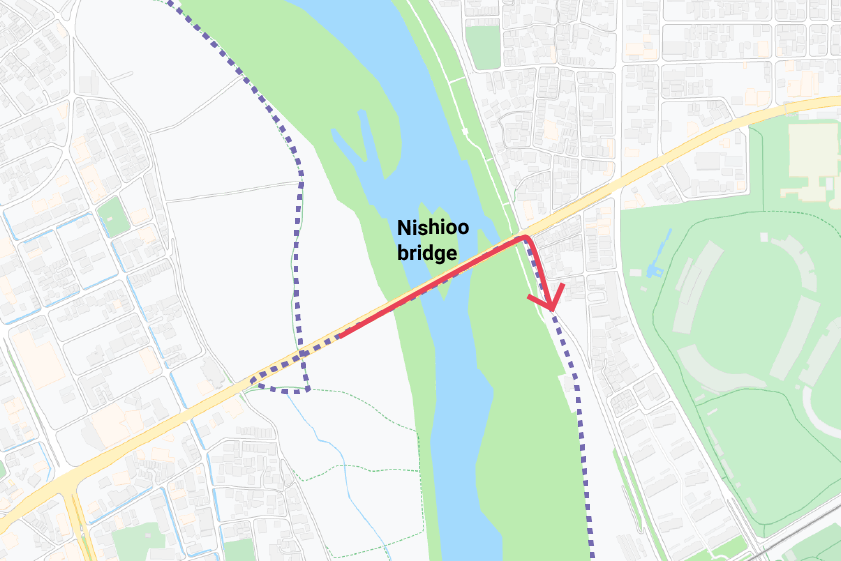
The trees and plant life that line the path are thick and vibrant. The riverside farms you’ll zip past make for some great scenery on the bike.
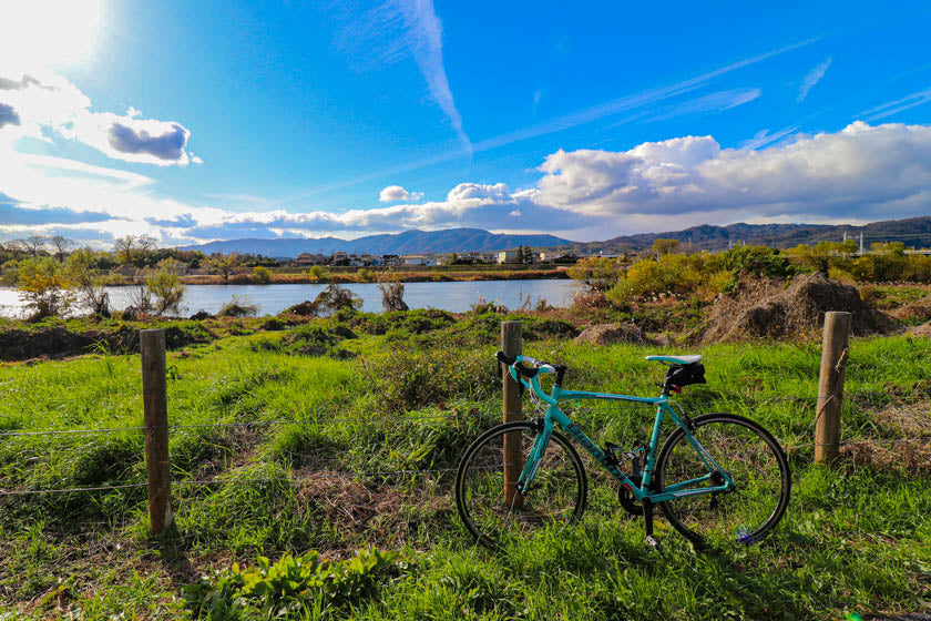
The delightful cycling continues south through agriculture and nature as the path rises and lowers giving some different vantage points from the bike.
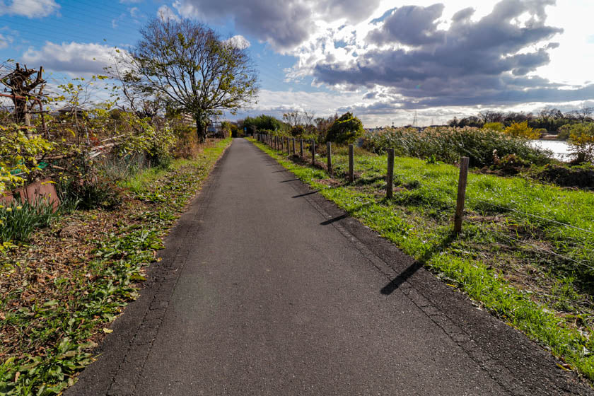
The Katsura river will be flowing on your right as you and the water slowly leave Kyoto behind on your journey to Osaka.
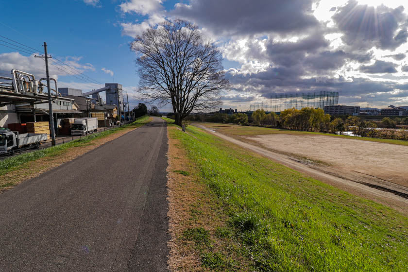
Switchback to higher ground
The route will take you under a bridge followed by a quick left then right, before you need to take the switchback on your left to get up onto the upper path.
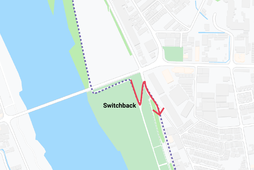
Make sure you take this path up to the higher cycling route as if you keep going straight you’ll eventually run out of road and will be forced to head back.
If you do go straight there is some rugged river-side scenery to enjoy but unless you want to swim, you’ll need to backtrack and get onto the elevated path.
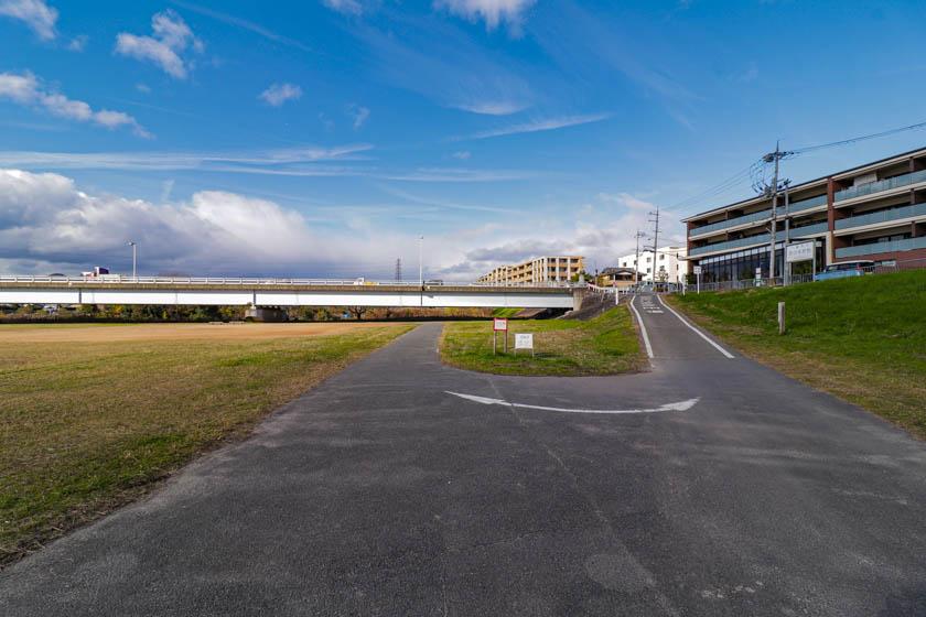
Over to Tenjin river
You’ll continue south before the path veers left and takes you over a small bridge and over to the Tenjin river.
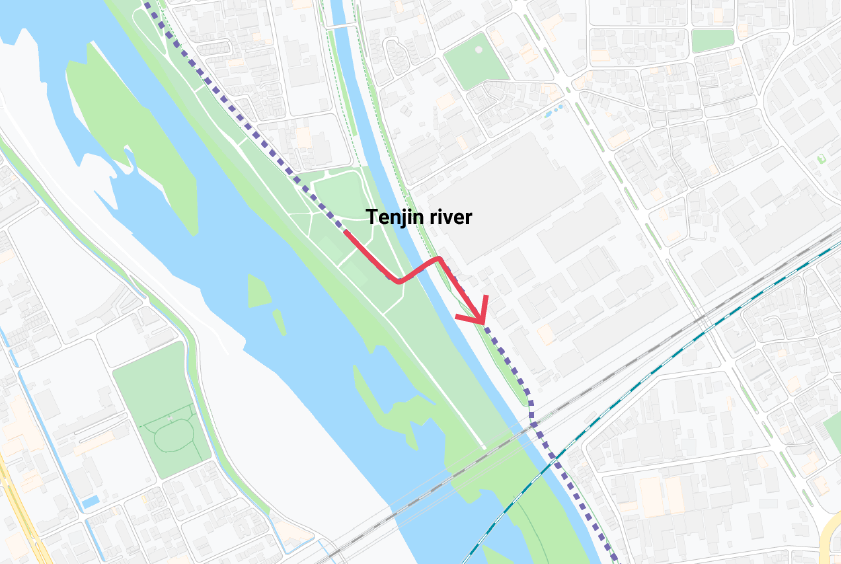
The Tenjin river actually flows into to the Katsura river but if you continue on the original path you’ll reach the end of a small island and be given the option of another swim.
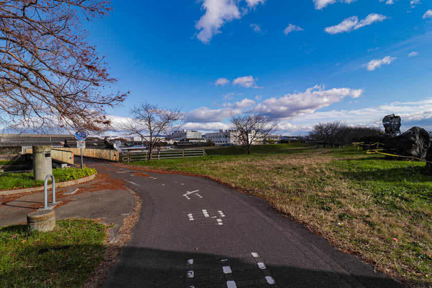
Continue along the Tenjin river for a few minutes before you merge back onto the Katsura river to continue your ride.
This section between the Tenjin river and the next section where we cross over to the Kamo river mark the half-way point of the Katsura river leg of the journey.
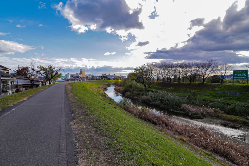
Left to Kamo river
You may know about the Kamo river but this is where the Katsura and Kamo river join and become one body of water.
In central Kyoto and further north, the Kamo river is an iconic location to the east of the city centre. It provides a convenient cycling path, nice places to exercise and also lovely areas to sit, relax and take in the beauty of Kyoto.
The Katsura and Kamo rivers border different sides to the city however as you head south the rivers join and become one.
The next area to navigate on our route is the left turn onto the Kyogawa bridge which takes you to the Kamo river before it joins the Katsura river.
You’ll also pass over a smaller river in the middle called the Nishitakase river before you get onto the Kamo river cycling path.
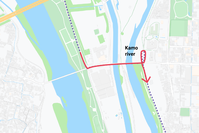
It is easiest to turn left at the end of the bridge and then loop back around down to the path in order to be heading south.
You can avoid crossing the road and go under the bridge instead.
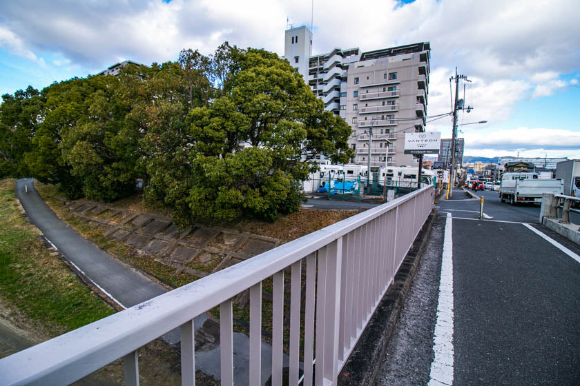
You then head south down the Kamo river for 2km before joining back up with the Katsura river.
Final stretch of Katsura river
You will find yourself on the final stages of the Katsura river leg of the ride.
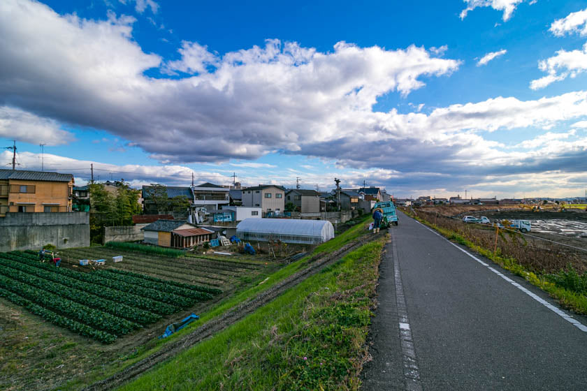
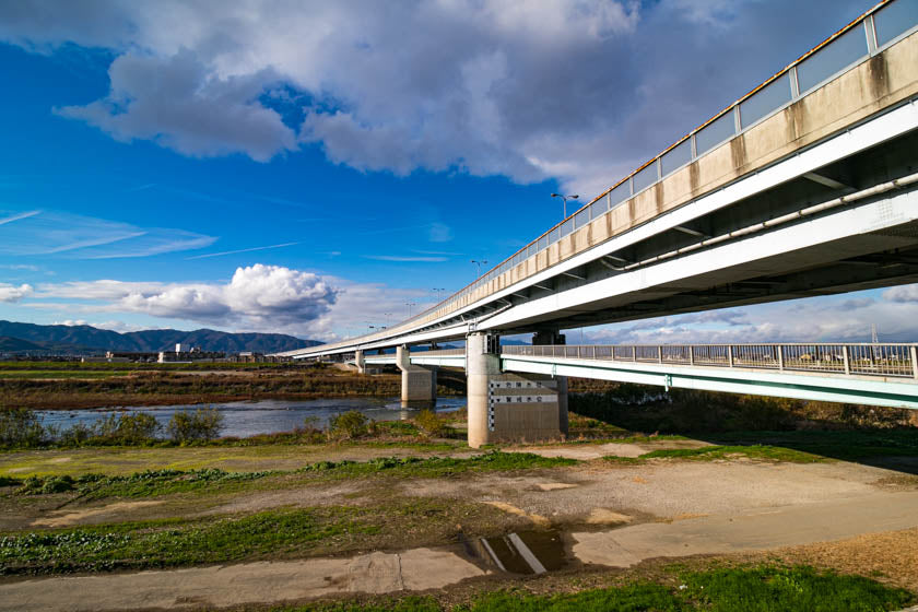
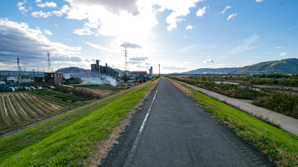
There are some beautiful moments to take in with mountains looming over to the west, bridges and highways cutting across the river, and the unmistakable Japanese farms lining the cycling path.
Three River Crossing
The three river crossing is the area where the Katsura river, Uji river and Kizu river come together just before they all join to become the Yodo river.
The bridges crossing the rivers just before the three river confluence is a good spot to stop for a quick drinks break and rest. The Yodogawa Riverside Park – Sakura building, has a distinctive tower and is on the east side of the bridge. It’s a popular spot for cyclists to stop, buy a drink if needed and rest the legs before the second leg of the ride.
Yodogawa Riverside Park – Sakura-deai-kan >
Of course, the Yodo river goes to Osaka, so on this route that’s the river we need to follow however the Uji and Kizu river are both gateways to other exceptional areas for cycling.
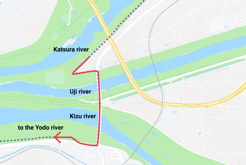
The Uji river takes you to Uji and through some spectacular scenery while the Kizu river takes you into Nara and into some stunning areas to explore.
If you are interested in exploring Uji on the bike be sure to check out our route and guide on cycling the area.
Kyoto, Uji and Otsu cycling guide and route >
Left to the tunnel
As you approach the Yodo river crossing you’ll be faced with the option of going left down a slight decline or right which goes up a slight incline.
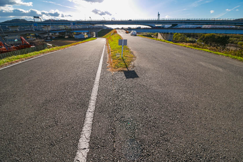
You want to go left here as this takes you through the tunnel and along the path for cyclists and pedestrians.
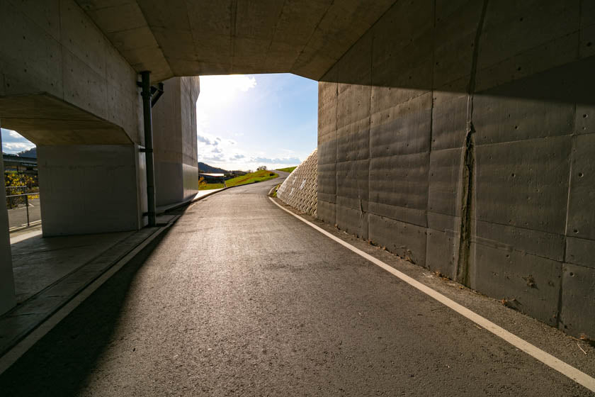
As you exit the tunnel and follow the path you’ll notice you actually overshoot the bridges which will be on your left and then behind you.
Don’t worry, you’re on the right path. You’ll loop around and end up turning right onto the bridges then crossing over.
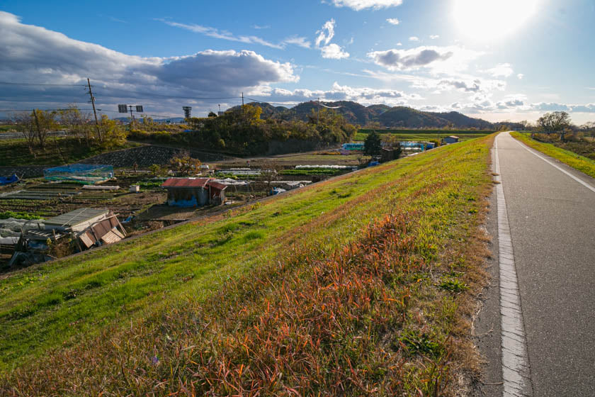
The image below is looking north towards Kyoto. You’ll cycle towards the camera then around the bend and over to the bridges you can see in the distance to the right.
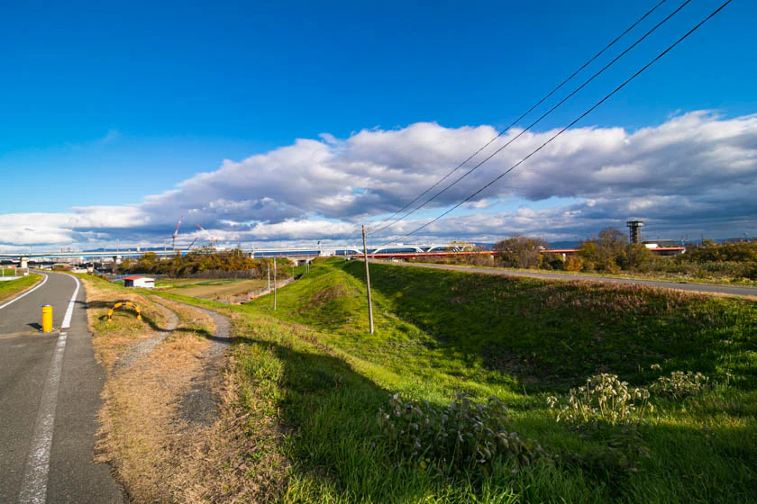
Ride over the bridges to the far side then turn right and get onto the cycling path and start your journey along the Yodo river.
Yodo river into Osaka
The Yodo river is the principal river in Osaka prefecture and historically was the backbone of trade and commerce between Osaka and Kyoto before the rise of trains.
The river cuts through the city before flowing out to Osaka bay which is a part of the inland sea. The bay is separated from the Pacific ocean by the Kii channel that is off the coast of the Kii peninsula in Wakayama.
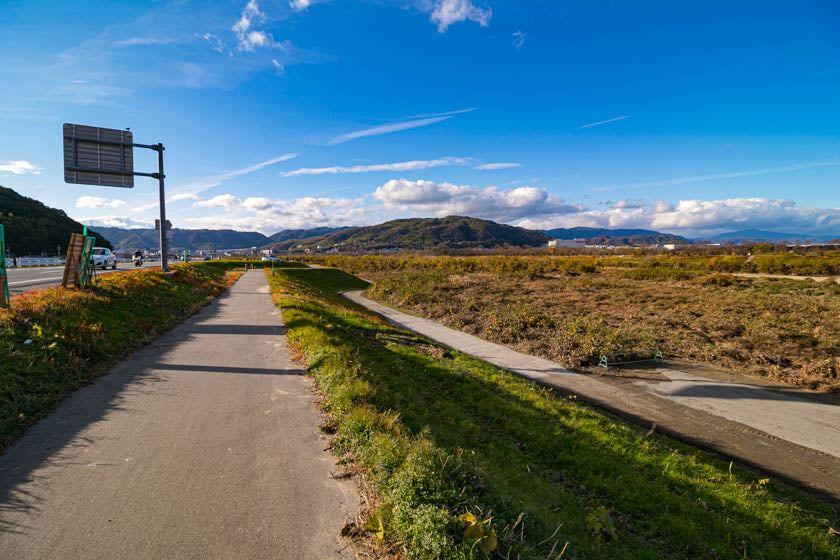
Kuzuha Golf Course
After cycling for around 3km you’ll get to a golf course where you veer right and follow the path as you get closer to the river.
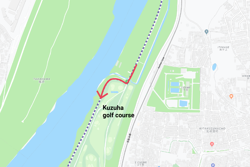
See the golf course and the right turn in the image below.

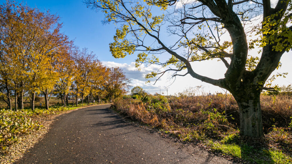
This part of the Yodo river route is one of the best sections for cycling on the Yodo river.
The river is very natural with lovely sandy sections and the path weaves around thick vegetation and then some areas that open up with lovely trees lining the path.
Right after bridge
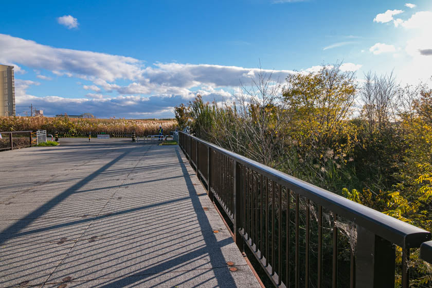
Keep riding and you’ll wrap around to the left and get to a small bridge.
You need to cross the bridge and turn right then keep pedaling through the trees towards Osaka.
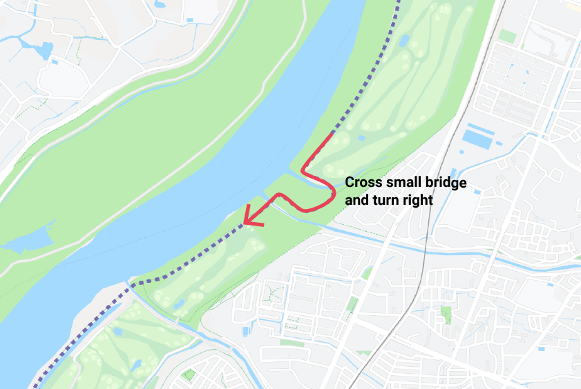
The small bridge can be seen in the image below.
Path options at Hirakata
Before too long you’ll reach a riverside city called Hirakata.
At Hirakata you’ll have a few different paths you can take so don’t panic if you are faced with a few different options.
You can go left and take the higher ground as is mapped on our route or head right and zip through the bush path which isn’t paved in a section (but there should be no problem using a road bike here).
I tend to go down the unpaved bush road and ride at water level but the elevated route does give you a nice view.
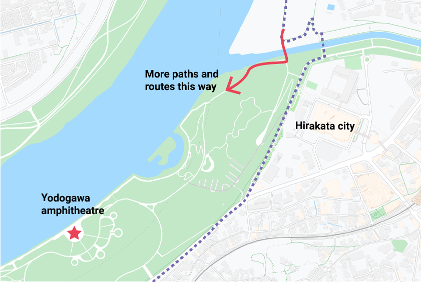
If you take the water level route and go through the grass and park area you end up going past an interesting amphitheatre which is worth a look.

Cycling bollards and gates
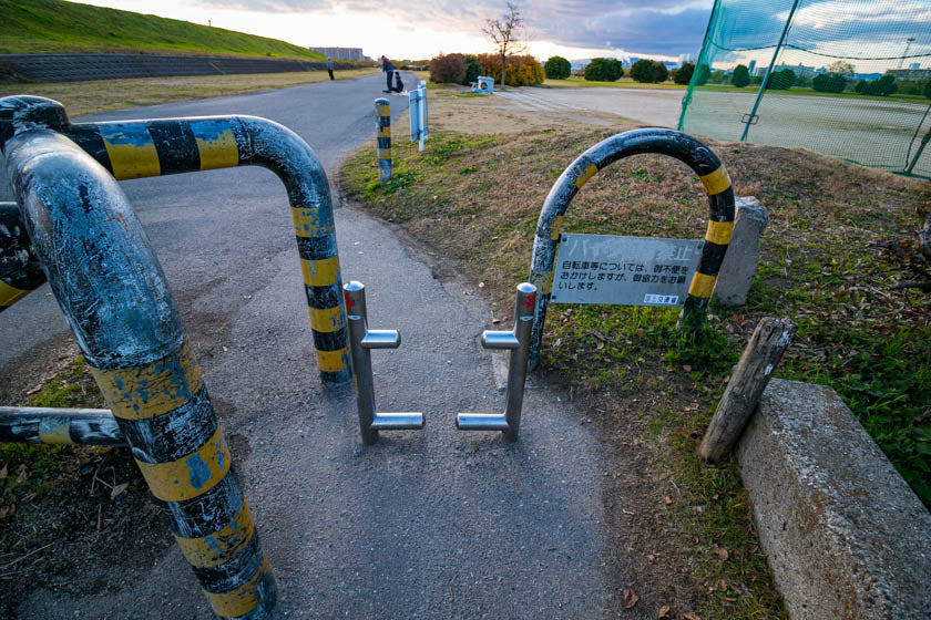
From Hirakata the dreaded bollard gates start appearing which slow the pace down, especially if you have cleats on or are cycling with panniers.
The gates were installed because some people used to fly up and down the Yodo river at night on scooters and motorbikes.
While the gates did deter the motorbikes, they also effect cyclists which is a bit annoying but you just need to slow down and take care as you go through so you don’t damage your bike.
Osaka city appearing
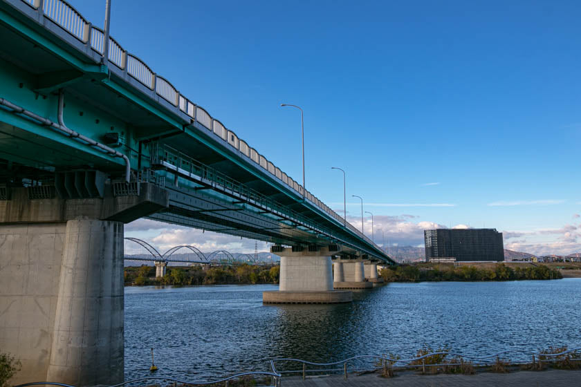
The ride continues and soon enough you’ll start seeing Osaka city growing larger in the distance giving you a sign that you are nearly there.

There are some interesting bridges, sports fields and pond areas where people fish in the final stretch of the Yoda river but generally, the closer you get to Osaka city the less scenic the river road becomes.
Oogawa river to Finish
As you near the end of the ride you need to go up a switchback and over to the Oo river which is the final leg of the route.
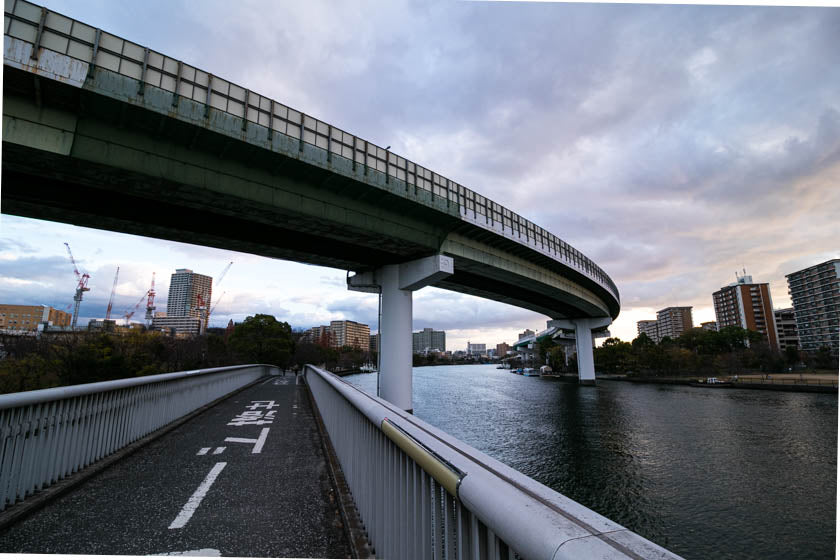
The Oo river is a great cycling path but it can get crowded with people exercising and other cyclists so take care and watch your speed.
The Oo river goes into the heart of Osaka and from there you can make your way to your final destination.
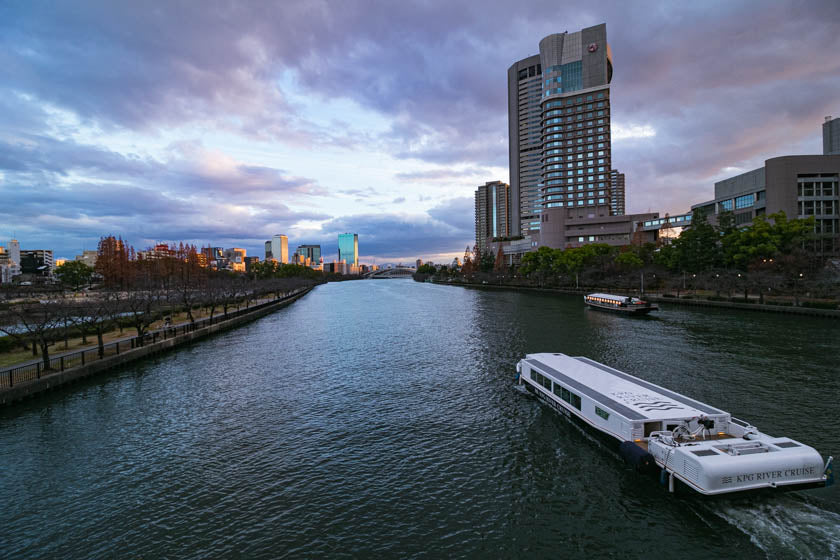
If you are going to RBRJ, our shop is on the left of the river just before Sakuranomiya station.
Final thoughts
The ride is easy enough for all skill and fitness levels and there are more than enough memorable sections to satisfy most cyclists.
One thing to watch is the wind on the rivers, especially the Yodo river. Sometimes there can be some pretty intense headwinds which can make for some tough riding but if you happen to get a tailwind you’ll be flying at record speeds.
The gates with the bollards on the Yodo river are also another downside to the route but once you get used to the crossings they are only a minor annoyance.
Overall, it’s a great ride and satisfying cycling experience.
If you get a chance to cycle from Kyoto to Osaka on the Yodogawa, let me know your thoughts by sending us an email. We would love to hear your tips and experiences cycling between the cities.
Happy Cycling!
